
ΜΟΝΕΜVΑSΙΑ
(Μονεμβασιά)
October 2020
Orientation
Monemvasia (Μονεμβασιά) is a town in Laconia, Greece, about 300km south of Athens. Even though the roads are excellent, you need a good four-hour driving to arrive at this spectacular spot of the Peloponnese.
Monemvasia is one of Greece's most beautiful destinations, but I have been postponing my visit there for years, favoring travel abroad. Thanks to limited travels abroad, though, because of the covid-19 pandemic, I finally decided to visit it for the first time in October 2020.
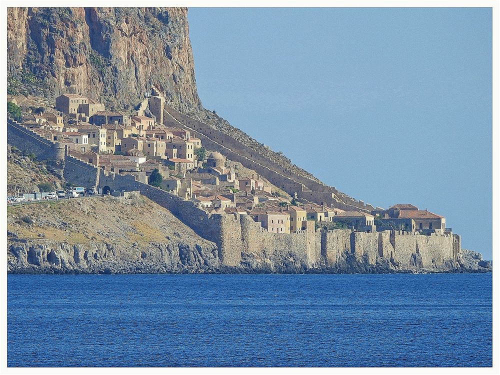
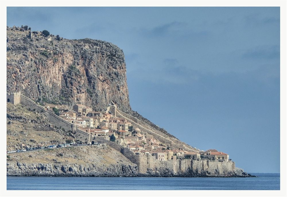
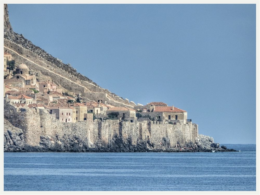
The name Monemvasia derives from two Greek words, 'mone' and 'emvasia,' meaning "single entrance" and refers both to the small island off the east coast of the Peloponnese and the fortified town on it. Its Italian form, Malvasia, gave its name to Malmsey wine. Monemvasia is nicknamed ‘the Gibraltar of the East’ because it resembles the bigger rock at the south part of the Iberian Peninsula.
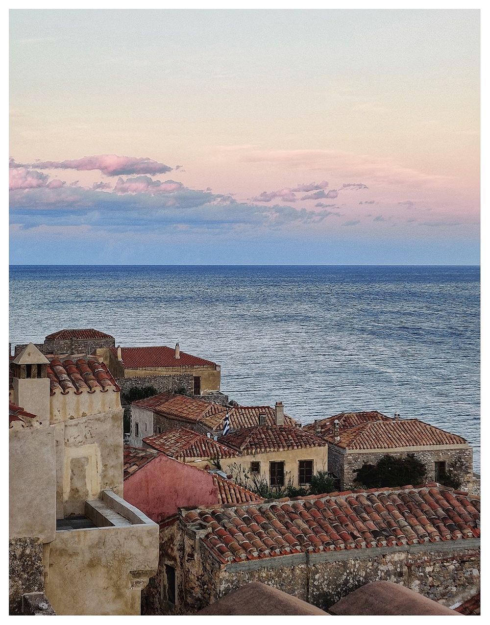
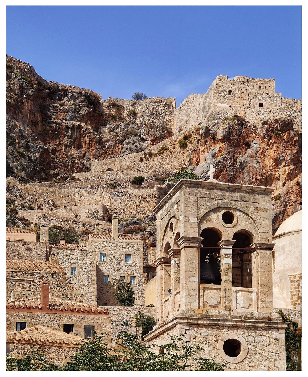
The island of Monemvasia was separated from the mainland by an earthquake in 375 AD. Today, it is linked to the mainland by a short causeway 200m in length constructed in 1971. Its area consists mainly of a large plateau some 100 meters above sea level, up to 300 m wide and 1 km long, the mighty medieval fortress site. The town walls and many Byzantine churches remain from the medieval period.
 to the main Gate of the fortified town. The yellow line shows the main road of the town. The blue line shows the lighthouse trail that follows the north shore of the island.")
Monemvasia island on the map. The green line shows the drive from Gefyra (on the mainland) to the main Gate of the fortified town. The yellow line shows the main road of the town. The blue line shows the lighthouse trail that follows the north shore of the island.
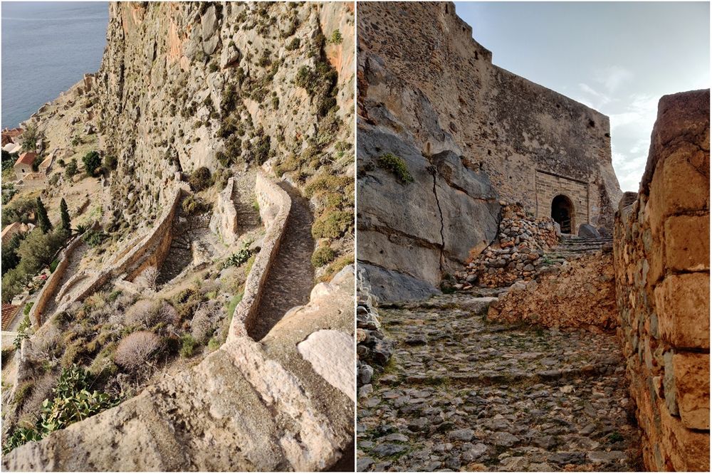
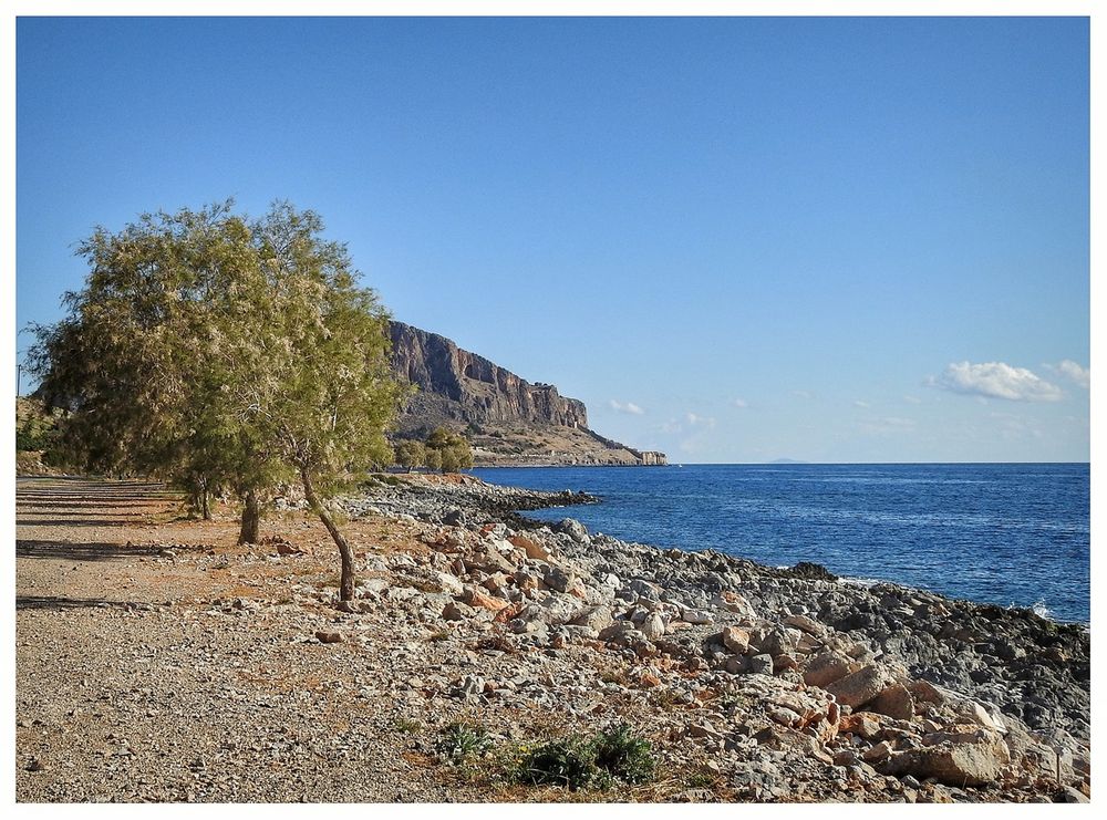
A rocky path surrounds the island following the coastline. It is not an easy path, but it worth following it as you can circle the island starting from the causeway and finish at the same point, enjoying the different views.
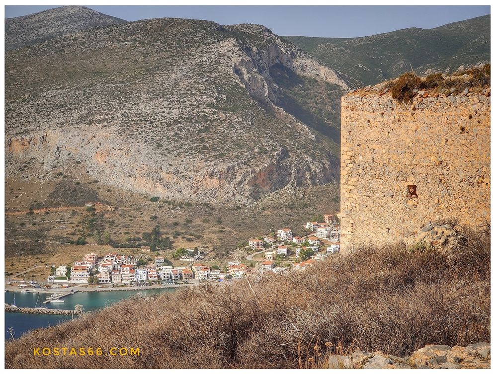
On the mainland, opposite the island, where the island's causeway starts, there is a small town called Gefyra ('bridge' in Greek). It took its name from the bridge, which used to be where the causeway to Monemvasia is today. In Gefyra town, one can find all the necessary town facilities: banks, post office, grocery stores, supermarkets, restaurants, cafes, etc.

The town of Gefyra seen from the Monemvasia Acropolis.
. The small harbor of Gefyra (right).")
The couseway connecting Gefyra to Monemvasia island (left). The small harbor of Gefyra (right).
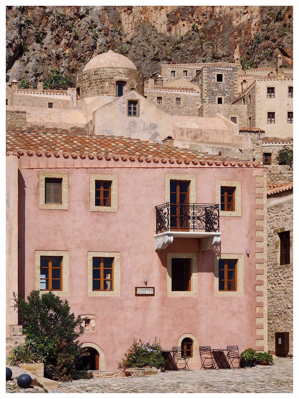
On the island, just after the causeway, there is a big car parking lot, a jetty for the boats to dock, and Lazareto Hotel. The building complex housing Lazareto Hotel is exclusively composed of historical buildings of public character. The hotel opened its ‘gates’ to the public in 1998 and took its name from the ‘Lazareto’ that the Venetians initially built at the beginning of the 18th century. The “Lazareto” (synonym to a quarantine) was purposely built outside the city walls to protect locals from disease, resulting from the increased maritime commercial traffic, which attracted many foreigners to Monemvasia from all corners of the Mediterranean. The massive two-floor square building overlooking the whole area at the beginning of the 20th century functioned as Monemvasia's local inn. Later, during the ’20s and ’30s, this building operated as the customs duty office that monitored the nearby harbor's commercial activity.
 on the island and the jetty close to it (right).")
The Lazareto hotel (left) on the island and the jetty close to it (right).
The distance from Lazareto Hotel to the entrance of Monemvasia Town is less than a kilometer. If you do not carry any big suitcases (the road is ascending), then the best way is to leave your car at the car park (next to Lazareto hotel) and walk uphill. Alternatively, call a taxi. You can drive to the castle entrance in your car, but it is almost impossible to find to park there. Actually, at any time of the day, you can see cars parked all the way from the parking lot to the castle entrance, forming a "silver line" that shines peculiarly from afar. If you are lucky enough, a car may leave a space the moment you drive by. Act fast, because many other cars are doing the same with you: drive up and down to find a parking space. For, me it's not a good idea, as you may end up very frustrated.
 and the main entrance to the fortified town of Monemvasia (right).")
Lazareto hotel (left) and the main entrance to the fortified town of Monemvasia (right).
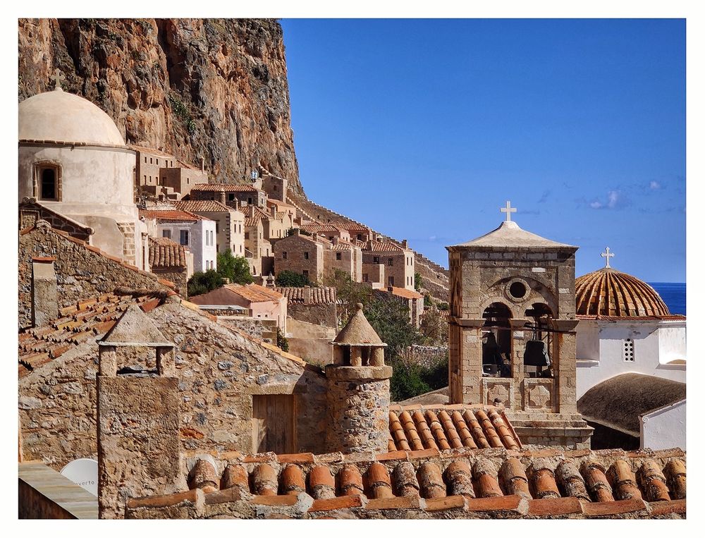
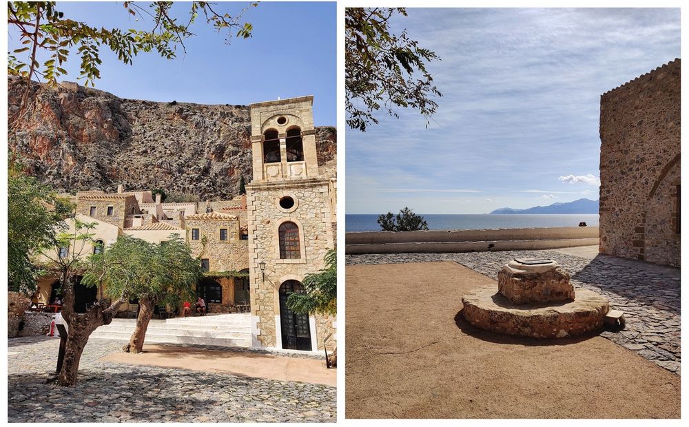
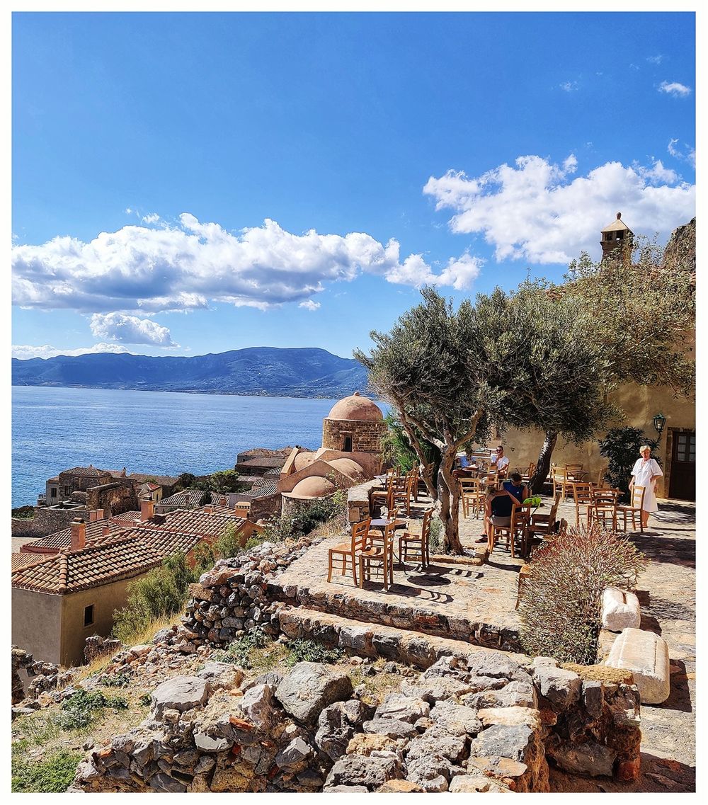
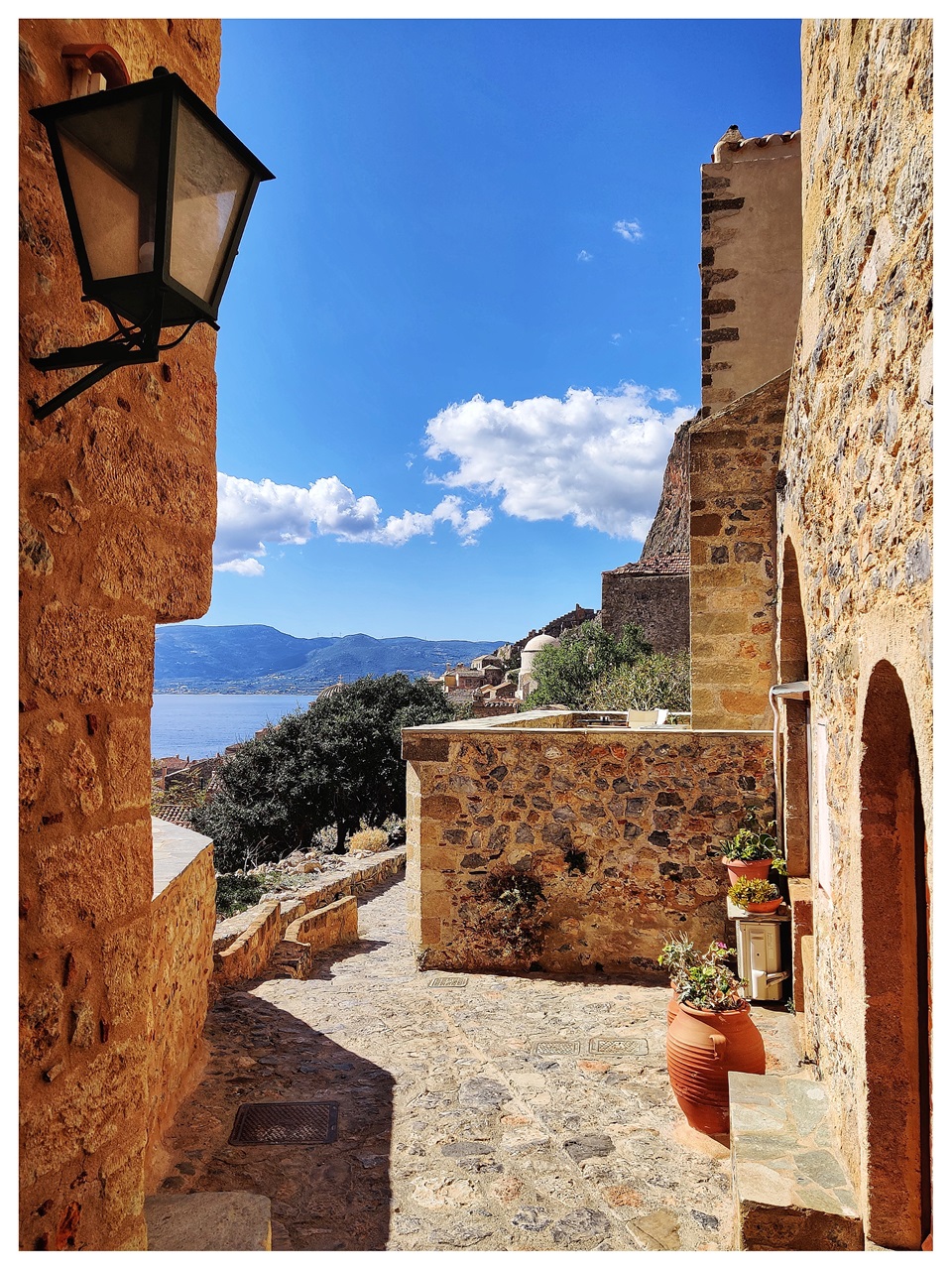
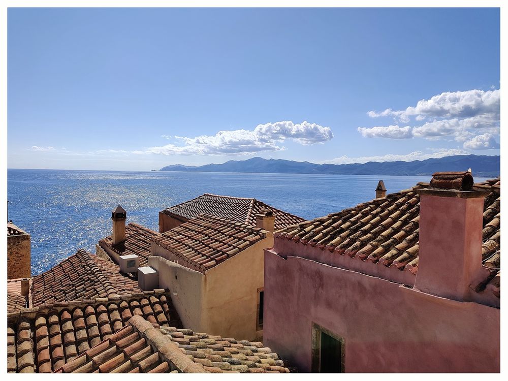
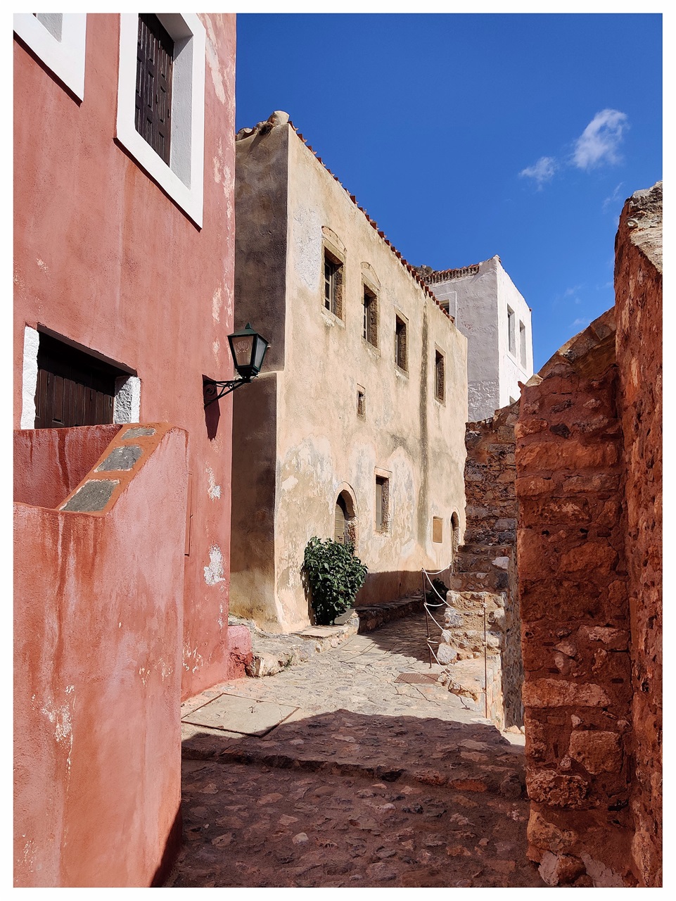
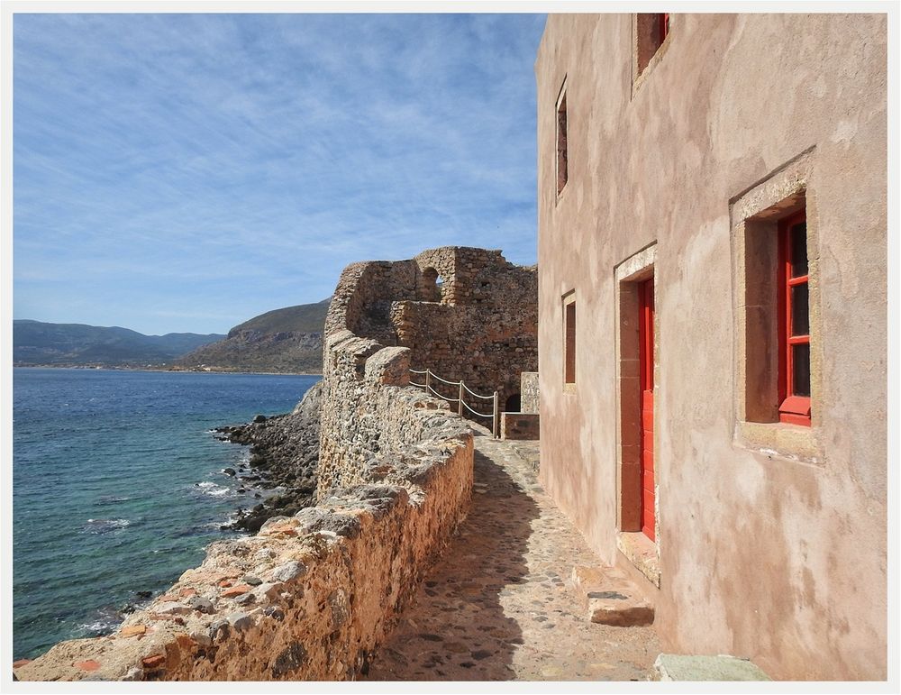
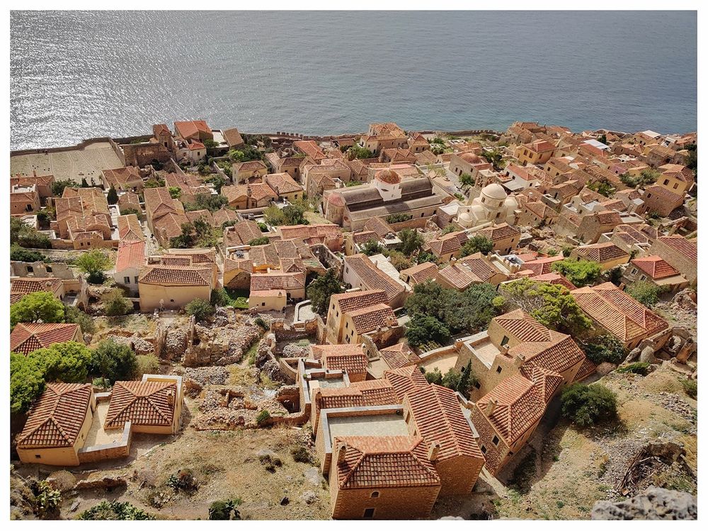
Monemvasia town consists of two distinctive parts: the inhabited part of Monemvasia, the Lower Town, located in the lower south-eastern part of the island, and the Upper Town, which occupies the island's highest position that forms a plateau. A path, called "voltes" (βόλτες) connects the Lower Town with the Upper Town. The Lower Town's fortification walls are very well preserved and restored to their old glory. A walk on the ramparts of the southern walls is a must.

A walk on the ramparts of the southern walls is a must.

Τhe southern walls seen from the sea.

A walk on the ramparts of the southern walls is a must.
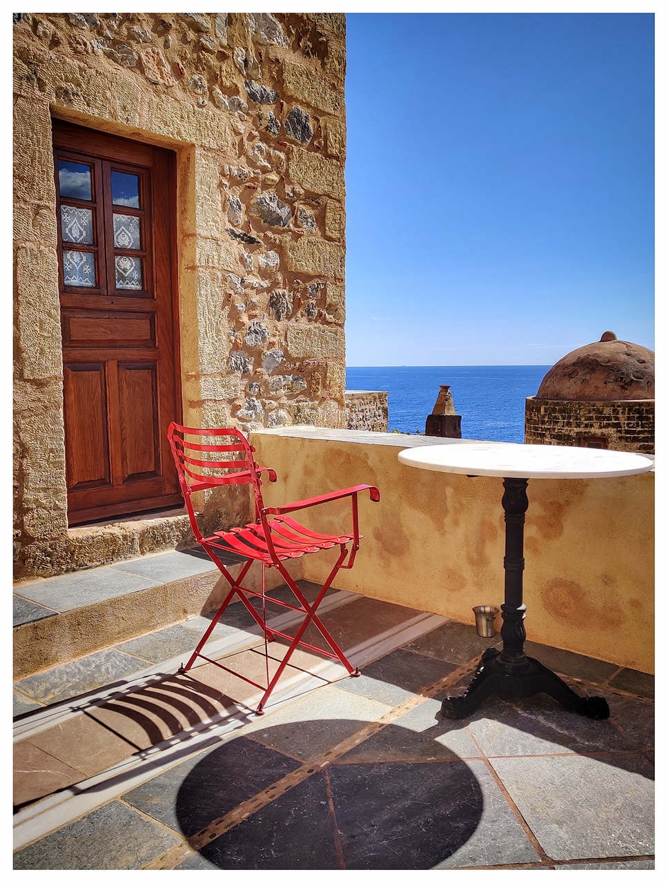
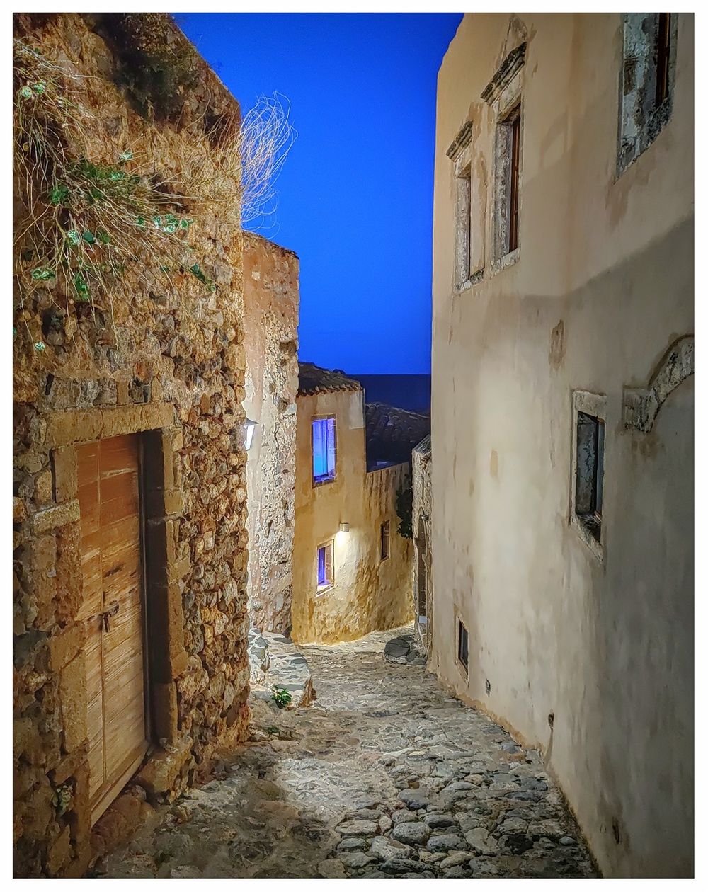
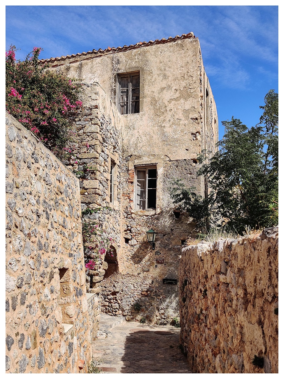
The area is highly touristic, and there are many hotels and apartment rentals, both on the island (the Lower Town) and in the surrounding area. The castle-town is restored beautifully to its medieval glory, so staying in one of the small hotels is certainly worth some extra money you have to pay. There are, though, drawbacks to staying in the castle itself: the rooms are generally small, and access to it is limited because no cars are allowed in the town. The streets are so narrow that only donkeys and small carts can fit in there. So, you must pull your suitcase into the town to your hotel. If you sit at one of the little cafes on the main road crossing the town, you see people dragging two-wheeled carts carrying building materials, food, and all kind of supplies to the town.
My verdict is: you may want to live your dream and stay in an authentic (as authentic that can be) medieval settlement, but you cannot bring all your princess' dresses and accessories up here; unless your prince charming is willing to sweat a lot for you and carry your massive suitcase to the hotel.

The main road that crosses the Lower Town from west to east is the widest road in town.

The roads in the town are very narrow and cars are not allowed of course.
I decided to stay outside the town and the island itself, some 4km to the south. Our hotel was built on the shore overlooking Monemvasia island. It was a charming little hotel.

The view of Monemvasia island from my hotel windows.
A brief history of Monemvasia
While uninhabited in antiquity, the rock may have been the site of a Minoan trading post. Pausanias, the renowned Greek traveler, and geographer referred to the site as "Akra Minoa," which translates to "Minoan Promontory." The town and fortress were founded in 583 by inhabitants of the mainland seeking refuge from the Slavic and the Avaric invasion of Greece. A history of the Peloponnese invasion and occupation was recorded in the ‘Medieval Chronicle of Monemvasia.’
From the 10th century AD, the town developed into an important trade and maritime center. The fortress withstood the Arab and Norman invasions in 1147. William II of Villehardouin took it in 1248, on good terms, after three years of siege. In 1259, William II was captured by the Greeks after the battle of Pelagonia, and in 1262 it was retroceded to Michael VIII Palaiologos as part of William's ransom.

A gravure showing the medieval Monemvasia at its full glory.
Monemvasia remained part of the Byzantine Empire until 1460, becoming the seat of an imperial governor, a landing place for Byzantine operations against the Franks, the main port of shipment (if not always production) for Malmsey wine, and one of the most dangerous lairs of pirates in the Levant. The Emperors gave it valuable privileges, attracting Roger de Lluria, who sacked the lower town in 1292. The town welcomed the Catalan Company on its way eastward in 1302. In 1397 the Despot of the Morea, Theodore I Palaiologos, deposed Monemvasia's local dynast, who appealed to Sultan Bayezid I and was reinstated by Turkish troops. In 1419 the rock appeared to have come into Venice's possession, though it soon returned to the Despot. About 1401, the historian George Sphrantzes was born in the town. After the fall of Constantinople in 1453, Monemvasia held out against Sultan Mehmed II's threats in 1458 and 1460, when it became the only remaining domain of the Despot of the Morea, Thomas Palaiologos, claimant of the Imperial throne. He had no forces to defend it; he offered it to the Sultan and finally sold it to the Pope.
By 1464 the inhabitants found the Pope's representative feeble and the Pope unable to protect them, so they admitted a Venetian garrison. The town was relatively prosperous under Venetian rule until the peace of 1502/3, in which it lost its farmlands, source of its food supply, and Malmsey wine. The food had to come by sea or from Turkish-held lands, and the cultivation of wine languished under Turkish rule. The Venetians governed the rock until the treaty of 1540, which cost the Republic Nauplia and Monemvasia its last two possessions on mainland Greece. Those inhabitants who did not wish to live under Turkish rule were given lands elsewhere. The Ottomans then ruled the town until the brief Venetian recovery in 1690, then again from 1715 to 1821. It was known as "Menekşe" ("Violet" in Turkish) during Ottoman rule and was a sanjak (province) center in the Morea Eyalet.
The town's commercial importance continued until the Orlov Revolt (1770) in the Russo-Turkish War, which saw its importance decline severely. The town was liberated from Ottoman rule on July 23, 1821, by Tzannetakis Grigorakis, who entered the town with his private army during the Greek War of Independence. In 1822 it became the seat of the first national assembly.
In more recent history, the town has seen a resurgence in importance with increasing tourists visiting the site and the region. The medieval buildings have been restored, and many of them converted to hotels.
The most notable person born in Monemvasia is Yiannis Ritsos (Γιάννης Ρίτσος), a famous Greek poet, a prominent member of the Greek Communist Party and an active member of the Greek Resistance during World War II.

Yiannis Ritsos.
The 1986 horror movie ‘The Wind’ was filmed here. The Wind (also known as The Edge of Terror and Terror's Edge) is a 1986 American slasher film co-written, produced, co-edited, and directed by Nico Mastorakis. It stars Meg Foster, Wings Hauser, Robert Morley, and David McCallum. The film follows a novelist who is under attack by an assailant during a windy night in Monemvasia.
The plot: Novelist Sian Anderson travels to the solitude of Monemvasia from her Los Angeles home to write her latest mystery book; she is also advised that a massive and robust wind will occur throughout the night and is recommended to stay indoors while the wind blows from the sea. While writing her novel, she witnesses the local handyman, Phil, murder her landlord, Elias Appleby, and soon comes under attack from the crazed psychopath. At the same time, the deadly wind continues to occur throughout the night.

"the Wind" film poster.
The Lower Town (Κάτω Πόλη)

Lower Town on the map.
The Lower Town is bisected by the main road that runs from west to east and connects the West (main) Gate with the East Gate. Here is where most restaurants, cafés, and shops are located.
 gate to the (Lower) Town.")
The main (West) gate to the (Lower) Town.
The life of the Lower Town is arranged around the two main squares. The Square of Elkomenos Christos, aka Kanoni square, is the busiest of the two, as it is located on the main road crossing the town. The square got its "unofficial" name from a cannon placed in the middle of it. The second square, Chrysafitissa Square, the larger of the two, is located in the east part of the town close to the East Gate. Both squares offer great views of the sea and the town.
"Kanoni" square. North view (left) and south view (right)

Chrysaffitisa square.
Notable churches
The large number of historic churches and monasteries in Monemvasia bears witness to the region’s long religious tradition. These places of worship attract many pilgrims and other visitors every year. They are also favorite sites for marriages and baptisms, both among locals and others from further afield.
“Church of the Elkomenos Christos” (Ναός του Ελκόμενου Χριστού)
The most famous and oldest church of the Lower town is the “Church of Elkomenos Christos” (Ναός του Ελκόμενου Χριστού), located at the “kanoni” square, the central square of the town. The church is mostly famous because of the Crucifixion priceless icon recently returned to it (in 2011) after being stolen by antiquities smugglers in 1979. Unfortunately, the church's interior was under renovation when I visited the area, so I did not manage to admire it.

The dome of the “Church of Elkomenos Christos”.

The “Church of Elkomenos Christos” seen from the Upper Town.
The church was built in the 6th or 7th century, with the city's first inhabitants' settlement. Its original form was a three-aisled wooden-roofed basilica, with a narthex to the west and an arch to the east, where a sizeable semicircular synthron was formed inside. During the 11th century, the other two arches, the intent, and the deacon, were added, and the older marble iconostasis was replaced with a new one, part of which is walled above the temple entrance. Extensive work was probably done in the 14th century.

The entrance of the “Church of Elkomenos Christos” and the cannon that gave the name to "Kanoni" square.
In 1520, during the years of the first Venetian rule, the Catholic Archbishop Arsenios allocated a significant amount of money to repair the church. In 1538, another donor, Count George of Corinth, whose surname in the inscription is falsified as "Kougkydas," replaced the columns with pillars to support the arches built on the site of the old wooden roof. In 1697, according to an inscription above the entrance, the exonarthex, the chapel on the south side, and the dome in the middle, approximately, of the building were added. The temple was destroyed in 1770 by the Turkish-Albanian invasion and was repaired several more times.

The belltower of the “Church of Elkomenos Christos” in Kanoni square.
Its interior is decorated with remarkable works of the 17th and 18th centuries, mainly portable icons. Its marble iconostasis, the work of Georgios Kaparia from Tinos, was built in 1901 and replaced the older wood carving. The most important relic of the temple is the famous large icon of the Crucified Christ (Crucifixion), which dates back to the 14th century and is a high artistic example of the painting of the end of the Palaeologan era. The icon, which was stolen in 1979 and after its discovery and restoration, was kept in the Byzantine Museum of Athens, returned to its natural place in 2011, and is exhibited in the chapel of Agios Ioannis (located inside the church). The famous hagiographer, Fotis Kontoglou, had characterized this icon as a masterpiece. The famous hagiographer, Fotis Kontoglou, had characterized this icon as a masterpiece: "perhaps the most important Crucifixion in a portable icon."

The facade of the "Church of Elkomenos Christos".
The adventure of an idiotic theft.
A multi-month thriller took place between 1979 and 1980 to locate Crucifixion's stolen icon, a thriller that inspired a successful TV series of the Greek state television called "Ierosyli" (sacrilegious) starring Thanos Livaditis and directed by Costas Lychnaras. Few people may know that when the icon was found, the then Minister of Culture Dimitris Nianias knelt in front of it and exclaimed, "the modern Parthenon was found"!
The icon was hijacked on the night of January 10, 1979, by a 47-year-old ex-military man expelled from the Armed Forces in 1962 on charges of "conspiracy against the regime." He then worked as a surveyor and was jailed for embezzlement and other financial law violations. In Korydallos prison, the 47-year-old met a 37-year-old antiquarian, who allegedly motivated the former to steal the image of the "Crucifixion of Christ" from the temple of the "Church of the Elkomenos Christos."

The crucifixion icon of the "Church of the Elkomenos Christos".
The 37-year-old antiquarian even asked the former military man for 500,000 drachmas (approximately 1,500 euros today) for the relevant information he gave him.
The 47-year-old had disguised himself as an old man, put on a fake beard, cut the door lock and entered the temple of Monemvasia and snatched a total of about 35 icons, including the "Crucifixion," the value of which was then estimated at 100,000,000 drachmas (about 300,000 euros). The man cut the image into three pieces and, after putting on the lieutenant's old uniform, loaded the icons in his car and transported them to two apartments in the center of Athens. Shortly afterward, he began negotiations to sell them by himself. However, his movements were noticed by the Athens Police, who prepared the big trap to catch the smuggler. A policeman man approached the 47-year-old pretending to be a German businessman interested in buying the icons. A few days later, the former soldier was arrested, and the icon of the "Crucifixion" was found on February 25, 1980, in an apartment.
Other notable churches in Lower Town are the Panagia Chrysafitissa church (Παναγία η Χρυσαφίτισσα), the Agios Nikolaos church (Άγιος Νικόλαος), and the church of Panagia Myrtidiotissa (Παναγία Μυρτιδιώτισσα του Κάστρου). At the Upper City stands the magnificent Hagia Sophia church (Αγία Σοφία).
Church of Panagia Chrysafitissa (Παναγία η Χρυσαφίτισσα)
At the edge of the Lower Town, on the large Chrysafitissa square, stands the small, all-white church of Panagia Chrysafitissa (Παναγία η Χρυσαφίτισσα), the city's patron saint. The church was built in the 17th century, during the Ottoman Empire, in the place of another, older church, of Panagia Odigitria (the "katholikon" of a monastery). Its construction is connected, according to tradition, with the finding of the icon of the homonymous miraculous icon of the Virgin Mary (Panagia), a work probably of the 15th-16th century. The icon was initially located in the village of Chrysafa in Laconia, whence the name "Chrysafitissa" (=of Chrysafa).

The Church of Panagia Chrysafitissa by the south fortification walls.
According to tradition, the Virgin Mary icon was initially located in the village of Chrysafa in Laconia. It miraculously arrived in Monemvasia, at the point where the church and the monastery of Panagia Chrysafitissa were later founded. The image was discovered there by an older woman, who immediately notified the bishop. All the Christians then gathered, received it, and processed it to the island's metropolitan church, where they placed it. That night the image disappeared. It miraculously returned to the place of discovery. After that, the inhabitants, satisfying the Virgin Mary's will, built a church and placed her icon in it. Beneath the temple springs a fountain, the only one in Monemvasia, whose miraculous water contributes to children's acquisition, mostly boys. In the meantime, the people of Chrysafa learned that their icon was in Monemvasia. So they went and asked for it from the bishop and the lords. The latter refused to give it, so the Chrysafa people resorted to court claiming their icon. They won the trial and returned satisfied to Chrysafa, carrying with them the Virgin Mary's image.

The icon of Panagia Chrysafitissa.
However, the icon was not happy with its transfer to Laconia. That is why it returned to Monemvasia, to its newly built church, where it performed exquisite miracles every day. Later, a nunnery was founded there.

Τhe church of Panagia Chrysafitissa on the homonymous square.
The church of Panagia is small in size, has a square plan, and is housed with a low dome supported by eight cantilevers. On its north side, a complex of cells has been saved, which belonged to an older monastery and today has been converted into a traditional hostel. The poet Giannis Ritsos (1909-1990) was born in this building, and his family lived here for a while. The church celebrates on the second Sunday after the Orthodox Easter Day with unique splendor. Then a procession of the Holy Icon of Panagia Chrysafitissa takes place in the Castle's cobbled streets.

The church of Panagia Chrysafitissa.
Church of Agios Nikolaos (Άγιος Νικόλαος)
According to the founding inscription placed on the triangular gable of the west entrance door, the Church of Agios Nikolaos (Άγιος Νικόλαος) in the Lower Town was founded in 1703 at the expense of the medical philosopher Andreas Likinios. The latter was a descendant of the Monemvasia family of Likini, whose members were priests and briefcases of the old metropolis church of the Elkomenos Christos.

Church of Agios Nikolaos.
We know from written sources that Agios Nikolaos was built near the ancestral home of Likinia and, in fact, on an older church, of Byzantine times, whose ruins are still visible on the south exterior. The monumental style of the domed building and its dominant position in the settlement undermines the founder's divine faith and gratitude. The Ottomans transformed the sacred temple into a storage space (arsenal).

The Church of Agios Nikolaos is seen from the higher neighborhoods of the Lower Town. Panagia Chrysafitissa stands behind Agios Nikolaos..
In recent years, the church of Agios Nikolaos operated as a school and, in this context, underwent a series of interventions for the operation of the new use, such as the construction of a dividing wall between the sanctuary and the main church. The period 1829–1830 housed the Monemvasia Mutual School and, from 1839 until the middle of the 20th century, the Monemvasia Primary School. Since then, the Holy Temple has remained closed due to construction problems and other damage it faced. In the meantime, small maintenance works were carried out that allowed for some years to host Scientific Symposia.

The church of Agios Nikolaos and the "big blue" of Myrtoo Sea.
Later took place restoration works on the temple, which was completed in 2006. And while all the additional elements that had altered its original architectural features were removed, the later solid wall separating the sanctuary from the main temple has been built in recent years for the housing needs of the Primary School of Monemvasia, was maintained, with the main purpose of not rendering the church for worship, but as a cultural space for hosting a variety of cultural activities.
Church of Panagia Myrtidiotissa (Παναγία Μυρτιδιώτισσα)
Just above kanoni square, in one of the uphill cobbled streets leading to the Upper Town, dominates the imposing, high facade of the church of Panagia Myrtidiotissa (Παναγία Μυρτιδιώτισσα), also known as 'Panagia Kritikia' because it was located in the district wherein the 17th-century refugees from Crete were settled.

The Church of Panagia Myrtidiotissa and Kanoni square at the back.
The church was built during the Second Venetian Occupation, around 1700, and local tradition states that the reason for its foundation was Philotheos Darmarios, bishop of Kythera who came from Monemvasia. In Kythira, which had trade relations and cultural ties with Monemvasia, the cult of Panagia Myrtidiotissa has since held a significant place.

The Church of Panagia Myrtidiotissa.

The Church of Panagia Myrtidiotissa.
The church is a single-aisle basilica with a dome, and its architecture combines Byzantine and Venetian elements. The configuration of the entrance with the gable, the round skylights, and the pointed cornices are characteristic influences of the western style. It is not excluded, in fact, that the same people who built the extensive fortifications of the Venetians in the Peloponnese worked here since the church, like others in the area, presents vital elements of fortress architecture. Inside the building, there is no painted decoration, and the wood-carved gilded iconostasis, which dates back to the 16th century, dominates. It is a work that is also characterized by renaissance influences, and it is noteworthy that it was moved here in the 19th century from the temple of the Elkomenos Christos, where it originally belonged.

The Church of Panagia Myrtidiotissa.
Other attractions
Monemvasia Lighthouse
Continue the road passing by Agios Nikolaos' church to the east, get out of the East Gate, and walk some meters to the Monemvasia Lighthouse. The lighthouse was established in 1896 and automated in 1960. The altitude of the tower is 7 meters, and the focal plane's height is 17 meters. The lighthouse and the surrounding building were renovated very recently. Next to the lighthouse building, there is a small exhibition place, where one gets information about this particular lighthouse and other notable lighthouses in Greece.
Monemvasia Lighthouse Trail is a 1.9-kilometer point-to-point trail, which starts from the lighthouse, follows the northern coast of the island, and finishes at the causeway on the western part of the island. It offers scenic views and is suitable for all skill levels.

Monemvasia Lighthouse.

Monemvasia Lighthouse.

The East Gate to the Lower Town and the Monemvasia Lighthouse seen from the south fortification walls.
Monemvasia Archaeological Collection (Αρχαιολογική Συλλογή Μονεμβασιάς)
At the Square of Christ Elkomenos aka Kanoni Square (it got its name from a cannon placed in the middle of the square) stands the Monemvasia Archaeological Collection building (Αρχαιολογική Συλλογή Μονεμβασιάς). The Archaeological Collection is housed in a historical building with many structural phases: it was initially built as a Muslim mosque during the Turkish occupation (16th century), was reformed into a public structure during the second Venetian occupation (1690-1713), and operated as a prison and coffee shop after the Liberation.
The Archaeological Collection of Monemvasia presents everyday memory elements and knowledge to identify the "renowned town," whose presence on the Peloponnese's rocky coast can be traced back to the 6th century A.D. The Collection was inaugurated in July 1999.

Monemvasia Archaeological Collection building on the "Kanoni" square.
Monemvasia's opportune site on the naval routes, its fleet which ruled over the important ports in the Mediterranean and the Black Sea, its famous products ("Malvasia" wine, for instance), members of its society distinguished in commerce, in "exercises of art" and in other spiritual activities, its local Archiepiscopacy, which raised significant personalities, but also the favor which has been given to the area through imperial chrysoboules, all made up the town's fame and prestige.
Within the area of the Castle of Monemvasia, which is itself a museum, the remaining monuments (Castle, fortifications, essential churches, houses, public buildings, Ottoman hammams, cisterns), which had attracted the attention of the scientific research, indicate Monemvasia's glorious past and highlight its historical route. However, information was missing for many various aspects of the inhabitants' life.

Monemvasia Archaeological Collection building on the Kanoni square. "Restaurant Kanoni" can be seen on the right of the picture.
The permanent exhibition was organized to present to the public archaeological finds from gathering and excavating into the Castle. They include historical testimonies of human activity and artistic life, which developed in the area from the early Christian years until the late Turkish occupation. Still, they also suggest Monemvasia's commercial and cultural contacts with other parts of Greece or abroad.

Monemvasia Archaeological Collection building on Kanoni square.
The exhibition's primary purpose is to promote public life elements through a group of sculptures belonging to the surroundings and private life through a group with miniature works of art and pottery. The exhibition has both educational and informational character, and the exhibits are accompanied, apart from their labels, by the appropriate bilingual explanatory texts. The route suggested to the visitor begins from the north internal part of the building, with a group of sculptures used in open spaces: the coats of arms, a western custom introduced during the Frankish occupation (sculpture with the lion of Venice, a plaque with relief coat of arms, dated to 1525) and sculptures related with the vital, for the Castle, matter of water and water supply (cistern's orifice, a plaque from a fountain, etc.).
Yiannis Ritsos House
Monemvasia has been praised by its most famous son: the poet Yiannis Ritsos. Initially, the Ritsos family lived in a house opposite the church of Panagia Chrysafitissa, but just after the poet's birth, they moved to the house located about 150 meters from the main gate of the Castle, next to the fortification walls.
Today outside the house, the great Greek poet's bust dominates, gazing at the deep Greek blue. As the house was huge for that time, they called it, as Ritsos's sister, Lula, noted, "the Inn of Gravia." In Monemvasia, Giannis Ritsos learned his first letters and tried to write his first poems at 8.

Me with Yannis Ritso's bust outside his house.

Yiannis Ritsos house in Monemvasia.
Ritsos will return to Monemvasia in the late '70s, where he will write the first poems of the collection "Monovasia" (1976). At the same time, his work is recognized internationally. Ritsos received in 1977 the Lenin Prize for Peace and Friendship of Peoples. The poet now returned definitively to his birthplace, the "Stone Ship," as he called it, after his death on November 11, 1990. The house was fully renovated in 2003 and recently bought by Monemvasia's municipality to house the Ritsos Museum.
Restaurants and more...
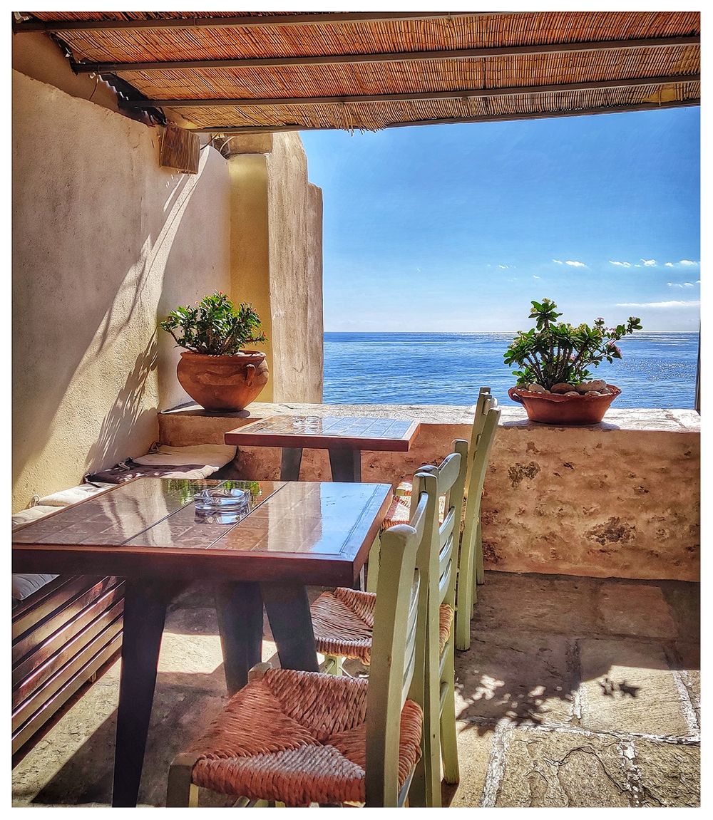
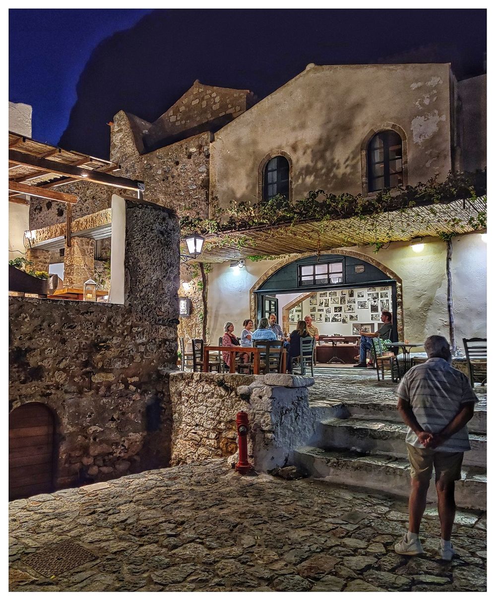
The Lower Town has several cafés, bars, and restaurants, almost all on the main road (the road that connects the Western and the Eastern Gates). All of them have beautiful views of the little gulf to the south of the island, called Limiras Epidavrou Gulf (Λιμηράς Επιδαύρου). The two most known restaurants are ‘Matoula Restaurant’ (Ματούλα), which serves traditional Greek dishes and ‘Kanoni Restaurant’(Το Κανόνι), which serves a fusion Greek-Italian cuisine. I visited both, and I was delighted with both the food and the service.

Pictures from the 2019 Korean TV series, “Chocolate".
. Kanoni square (top right). Most restaurants and cafes in the Lower Town have wonderful views (bottom right).")
Matoula restaurant (left). Kanoni square (top right). Most restaurants and cafes in the Lower Town have wonderful views (bottom right).
There is a nice story behind “Kanoni Restaurant’ how it became famous in South Korea! The 2019 Korean TV series, “Chocolate,” was partly filmed here in this restaurant. The leading lady worked here as a chef! Actually, this is how I heard about the restaurant, too. I had seen part of the series (a rather silly all-young cast series of K-culture) some months before visiting Monemvasia. At Kanoni, try the traditional ‘Skioufikta’ pasta dish, with beetroot, fresh onion and garlic, walnuts, and yogurt cream.
.")
Kanoni restaurant. Try the traditional ‘Skioufikta’ pasta dish, with beetroot, fresh onion and garlic, walnuts, and yogurt cream (bottom right).
There are also several souvenir shops here in the main street.

The main road of the Lower Town.
Portelo
From Kanoni square, follow the cobled little streets to the south to find ‘Portelo’. Portelo is the third Gate of the city, the only one on the sea. There is a small harbor outside the gate, which used to be the suppling center of the castle once upon a time. Today, people come here to swim or sunbathe on the rocks. Do not think of any sandy beach, just a small plateau and rocks from which you can dive into the super clear waters.

Portelo.

Portelo.
The Upper Town (Πάνω Πόλη)

Upper Town and its main attractions. Yellow line marks the recomended trail one can walk.
At the higher neighborhoods of the Castle starts the "voltes" (βόλτες), as the locals call the winding fortified road, ascend to an imposing gate, which is the entrance to the Upper Town (Πάνω Πόλη). What used to be once the center of the city administration and the residence of aristocratic families has been in ruins for centuries.
"Voltes" (left) and the Gate to Upper Town (right).

The Gate to the Upper Town.

The Gate to the Upper Town.
Recently significant projects have taken place in Upper Town (which remained closed for a long time) and are now open to the public. As part of the work carried out, the Upper Town neighborhood was “rediscovered” and emerged. It includes the complex of the main gate with its individual spaces and the nearby anonymous church, two houses, and a network of roads, which connects the gate with the most brilliant Byzantine monument of Monemvasia, the church of Agia Sophia or Panagia Odigitria (the only building that is maintained in excellent condition in Upper town).
.")
At the neighborhood of the Upper Town, just after the Gate to it. The unnamed church (right).
These monuments constitute an interesting unit of the castle's residential ensemble, providing comprehensible and didactic information about the organization and functions of a castle town with continuous use from the 6th to the 19th century (in 1911 left the last resident from the area).

At the neighborhood of the Upper Town, just after the Gate to it.

At the neighborhood of the Upper Town, just after the Gate to it.

At the neighborhood of the Upper Town, just after the Gate to it.
The only building of Upper Town which is functional is the Church of Agia Sophia, aka Panagia Odegitria (Ναός της Θεού Σοφίας ή Παναγία Οδηγήτρια). Our knowledge regarding its history is limited due to the absence of relevant inscriptions and written sources. At older times, the church was related to emperor Andronikos II Palaiologos (1282-1328), but it is proven that it is older. According to the latest research, it dates from 1150 and is related to the Normans' successful repulsion in 1147. Initially, it was dedicated to Panagia Hodegetria (Leading Virgin), but we don’t know if it was the catholicon of a monastery or a parish church. In the years of the first Venetian domination (1463-1540), it passed into Catholic hands, and during the Turkish Occupation (1540-1690), it was converted into a mosque. During the Second Venetian Occupation (1690-1715), it became a church once again, the catholicon of a monastery dedicated to Madonna del Carmine. Then they added the two-story exonarthex along with its western side.

The Church of Agia Sophia in the Upper Town.
In 1715 it was converted into a mosque again, until 1821, when the castle was surrounded to the Greeks, who demolished the minaret, which was on the southwestern corner, and dedicated the church to Agia Sophia, as it was believed to be a faithful replica of Aghia Sofia in Constantinople, the former Byzantine metropolis. The western side was restored in 1827 and in1846; the entire church underwent considerable restoration by Evstathios Stikas in 1958-59.
.")
The Church of Agia Sophia in the Upper Town. The facade of the Church (on the left picture).
The church belongs to the so-called “continental” octagonal, domed type and is considered one of its most beautiful examples. A characteristic of this architectural type is that the main church is a unified area, since the eight pillars that support the dome, are towards the edges. On the four corners of the mainly square church there are chapels, on the eastern side there is a tripartite bema and on the western a narthex. The masonry is carefully done with the cloisonné system. At the interior of the church the fragments of wall paintings, of exceptional artistic quality, date from the 12th century. The wall paintings at the prosthesis with scenes from the life of Agios Nikolaos are related to the snatching of the saint’s relics, which were stolen by Italian merchants from Myra in Lycia in 1087 and, while they transferred them to Bari, their ship stopped at the port of the castle. Of exceptional technique is also the surviving sculpted marble decoration, an important example of sculpture of the 12th century.

Inside he Church of Agia Sophia in the Upper Town.

Inside the Church of Agia Sophia in the Upper Town.
 and the dome (right).")
The Church of Agia Sophia in the Upper Town. The marble relief above the main entrance (left) and the dome (right).

Frescoes in the Church of Agia Sophia.

The Church of Agia Sophia in the Upper Town.
Avoid the hottest time of the day and be sure to wear sturdy shoes and comfortable clothes. The entrance to the church is free of charge. For opening hours call 2732061403, or ask at the museum in Kanoni Square.

The Church of Agia Sophia in the Upper Town.
The Upper Town has some trails that the visitor can follow and visit the remains of the town, but most of all to enjoy the panoramic views. The visitor understands why Monemvasia was an inspiration for travelers and poets.

The path from the Church of Agia Sophia to Goulas.

The views from Goulas.
At the highest point of the rock, at the location called Goulas, stand the ruins of the citadel (the Acropolis) built during the Venetian rule. The citadel is a Byzantine fortress, square in plan, with towers at all four corners. A rectangular, vaulted-roofed building was erected on the southwest tower site, which was used as a munitions store from the second Venetian rule (1690-1715) until the Second World War. From the northeast corner of the fortification extends a mighty wall built during the first Turkish rule (1540-1690) to ensure the security of the original winding ascent (known as “παλαιές βόλτες” – Old Walks) to the Upper Town. The Venetians repaired the wall during the second Venetian occupation (1690-1715) and called Mura Rossa (Red Wall) because of its masonry's red mortar. The wall terminates at a round tower, which in post-byzantine times the tower was converted into a windmill.

Goulas in the Upper Town seen from afar.
. The Mura Rossa (right).")
The rectangular, vaulted-roofed building, which was used as a munitions store (left). The Mura Rossa (right).
The ornamental brickwork lettering "Θ Π Ο Δ" ('Theodore Porhyrogenetos the Despot') on part of the east wall of the fortress, corresponds to the building works carried out on the walls during the despotate of Theodore II Paleologos (1407-1448).

The Goulas in the Upper Town.
From the Acropolis, follow the path to the south till "Katergo" water tank and continue east to exit from the Upper Town.
The main criterion for choosing a location for the founding of a city during the Byzantine period was water. The lack of spring water in Monemvasia led to the creation of an organized water supply system with the construction of cisterns for collecting rainwater. These are rectangular vaulted structures coated with hydraulic mortar ('kurasani') to ensure their sealing. Cisterns for public use are located in the free public areas of the settlement, temples, and other public buildings. There are three large public cisterns in Upper Town, the "Katergo" or "Galeazza," the "Karavi" or "Galera," and the "Keratsini" or "Bastarda." Rainwater is collected internally from collecting surfaces and is pumped from orifices formed in their dome. In addition to the public tanks, private cisterns are built on the lower level of the houses. The collection of rainwater from the roof is achieved through a system of clay pipes. They are pumped from stone mouths that, in some cases, have embossed decoration.
The most important of all cisterns, "Katergo" or "Galeazza" cistern, is a semi-underground vaulted construction of post-Byzantine times with a collecting surface on its north side. It comes from the reconstruction of an older building and is surrounded by ancillary buildings.

"Katergo" cistern (left). "Goules" (right).
Beyond Monemvasia
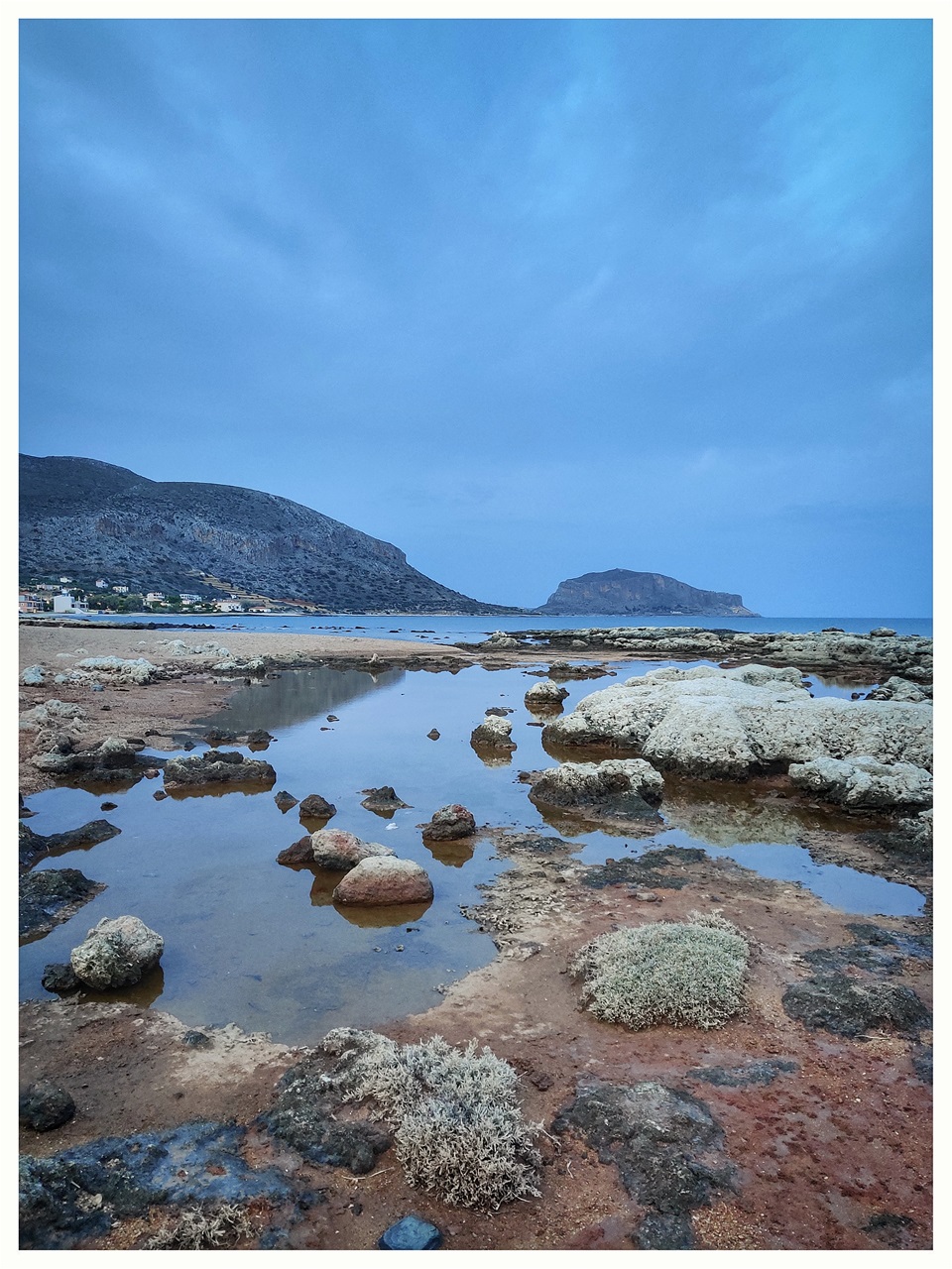
The Monemvasia adventure does not finish in the Castle and on the island. Gefyra town offers a good variety of restaurants, bakery shops, cafés and beautiful vistas of the island and its castle. Not far away from the island, to the north, the archeological site of Epidavros Limira (Αρχαιολογικός Χώρος Επίδαυρος Λιμήρα) certainly worth a visit. While being there, do not miss swimming in the clear waters of Myrtoo Sea and sunbathe at the long sandy beach of the area.
Also to the north of Monemvasia, Ierakas (Gerakas) and Kyparissi are two secluded picturesque villages by the sea that will amaze the visitor with their serenity and beauty. Ierakas is only 30 minutes drive, while Kyparissi is 90 minutes drive. Both villages have several cafes and restaurants.
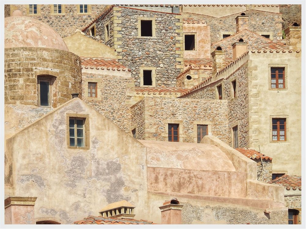
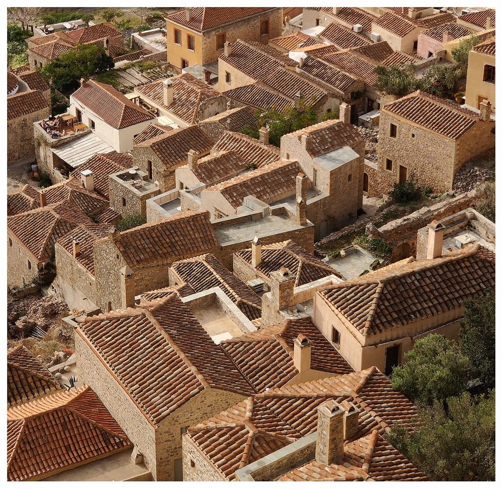
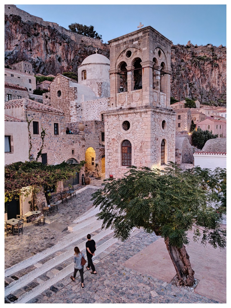
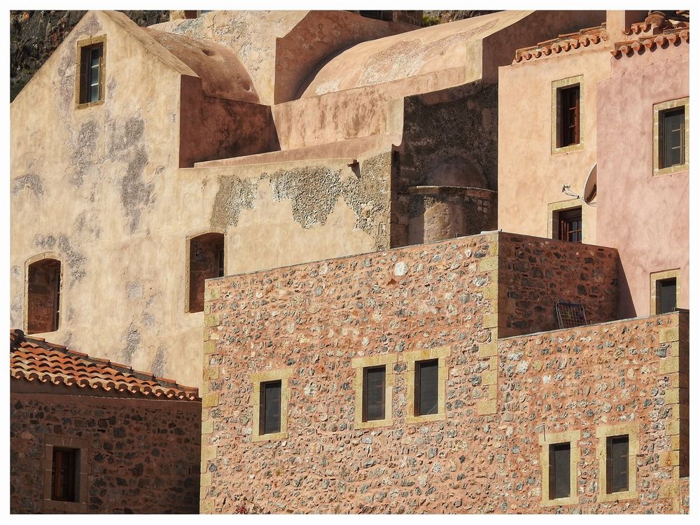
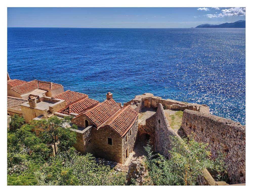
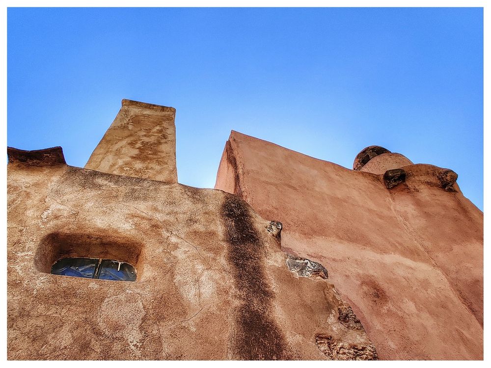
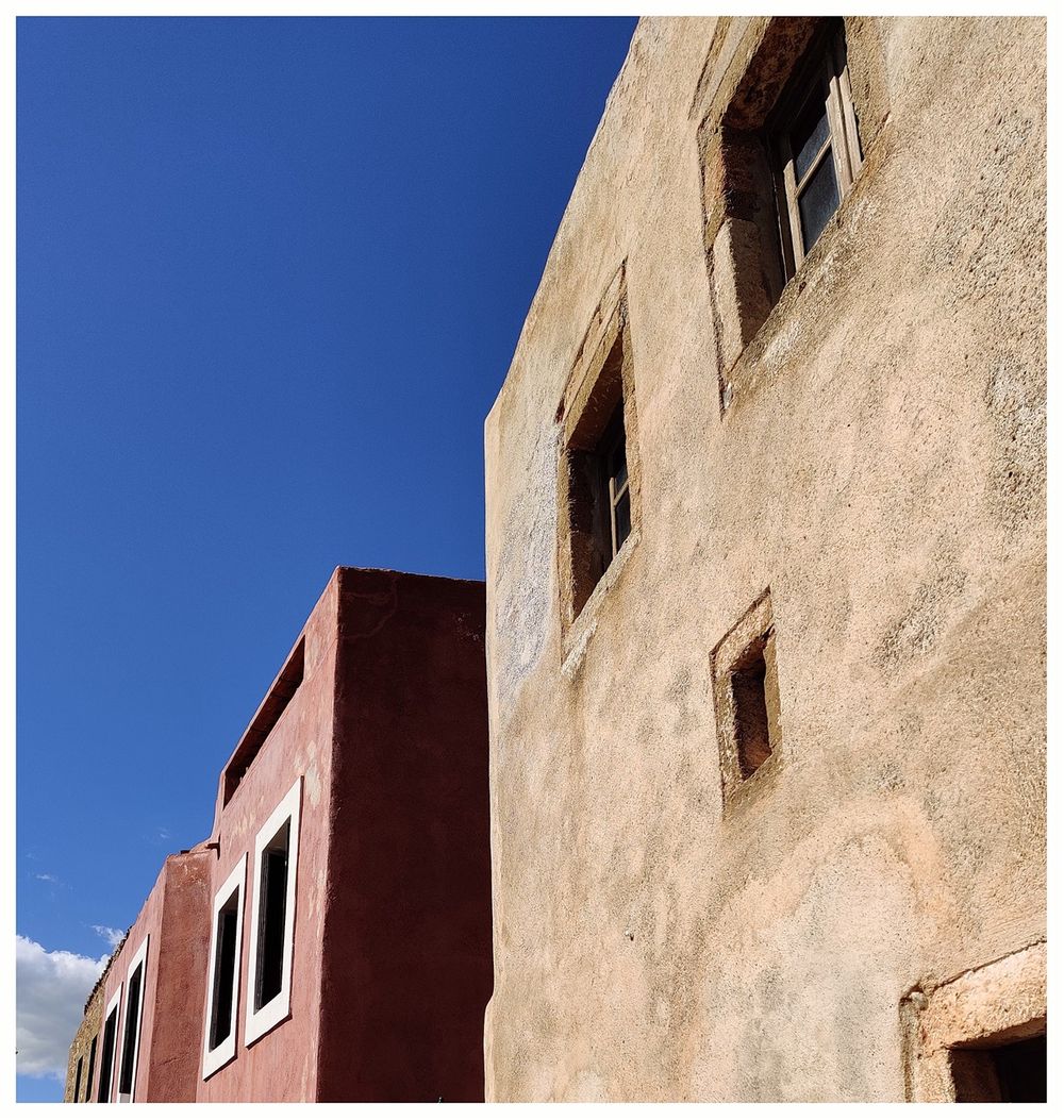
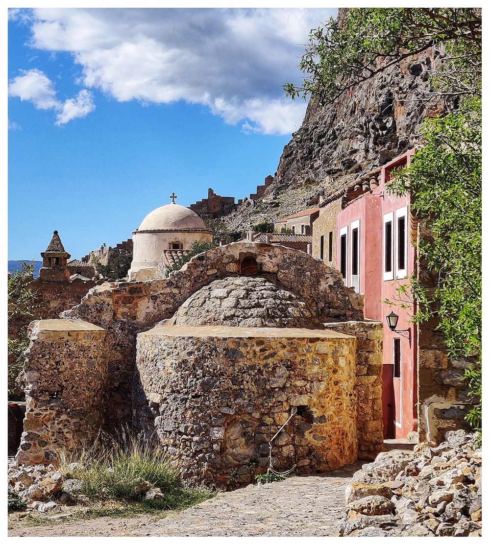
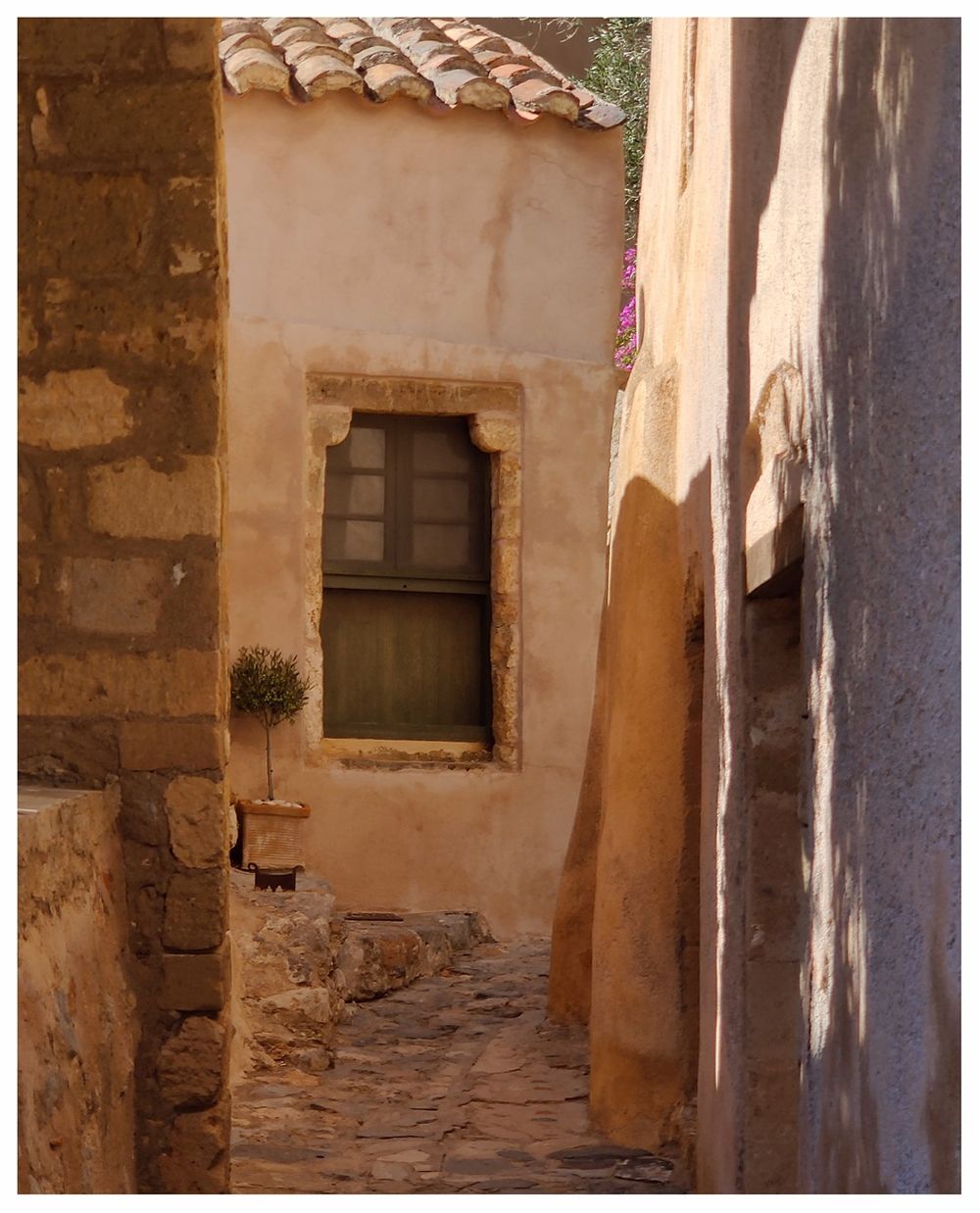
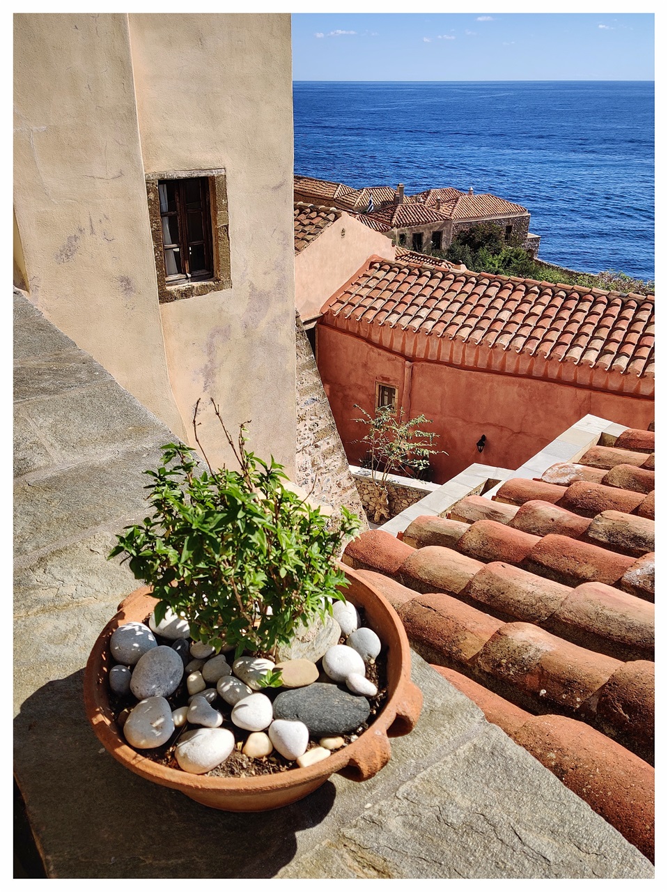
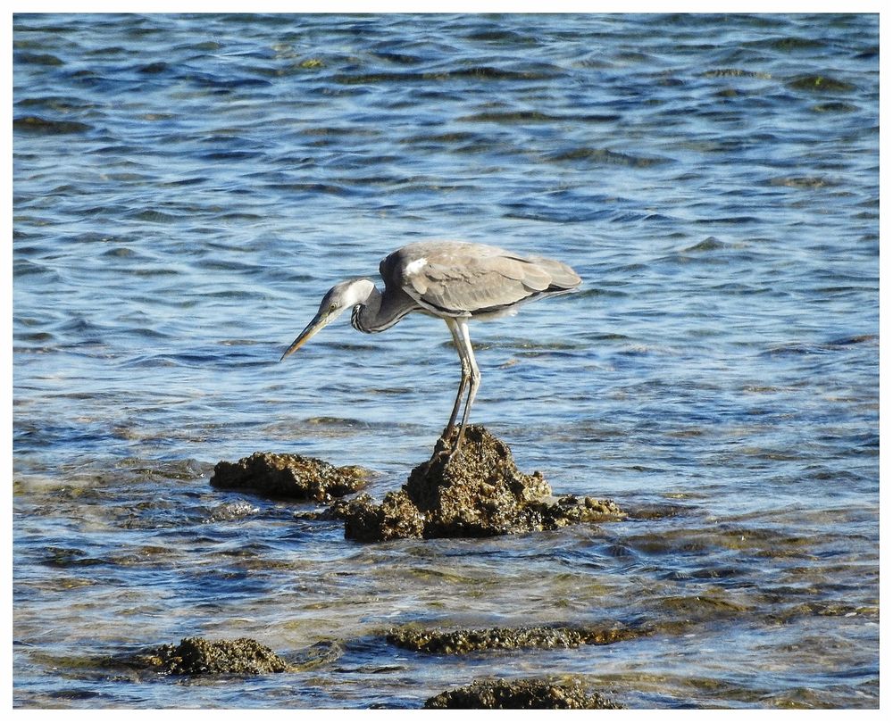
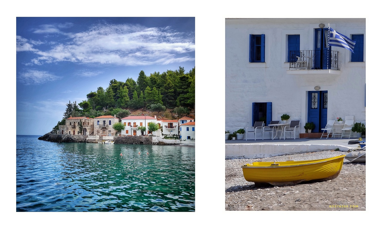
Just pictures of Monemvasia
MONEMVASIA
a photo travel

